William S. Kearney, Gina Arnau, Theophil Bringezu, Michael Dietze, Boris Gailleton, Anna-Lena Lamprecht, Kilian Lenz, Richard Ott, Dirk Scherler, Philippe Steer, and Wolfgang Schwanghart
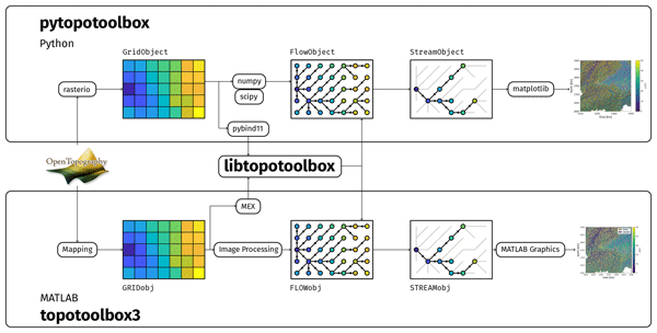
TopoToolbox is a software package that enables users to analyze maps of the Earth's surface. The newest version of TopoToolbox makes it accessible to more users, makes it easier to integrate TopoToolbox with other software used to study the Earth's surface and establishes a new development process to ensure that TopoToolbox continues to meet the needs of its community of users. We present a series of examples to demonstrate how users can incorporate the new TopoToolbox version into their work.
This paper presents the latest iteration of the TOPOTOOLBOX software that has been extensively used over the last ten years for analysing landscapes for geomorphic/earth science research.