
Articles | Volume 14, issue 4
https://doi.org/10.5194/esurf-14-635-2026
© Author(s) 2026. This work is distributed under
the Creative Commons Attribution 4.0 License.
the Creative Commons Attribution 4.0 License.
https://doi.org/10.5194/esurf-14-635-2026
© Author(s) 2026. This work is distributed under
the Creative Commons Attribution 4.0 License.
the Creative Commons Attribution 4.0 License.
Research article
| 
25 Aug 2026
Research article |
| 25 Aug 2026
| 25 Aug 2026
Lift or impact: modelling bedrock incision coupled with sediment dynamics
Philippe Davy
CORRESPONDING AUTHOR

Géosciences Rennes, Fractory, CNRS, Université de Rennes 1, Campus de Beaulieu, Rennes, France
Wolfgang Schwanghart
Institute of Environmental Science and Geography, University of Potsdam, Potsdam, Germany
Institute of Geographical Sciences, Freie Universität Berlin, Berlin, Germany
Jürgen Mey
Institute of Environmental Science and Geography, University of Potsdam, Potsdam, Germany
Caroline Darcel
Itasca consultants, Fractory, Campus de Beaulieu, Rennes, France
Angela Landgraf
National Cooperative for the Disposal of Radioactive Waste, Wettingen, Switzerland
Related authors
Marine Le Minor, Dimitri Lague, Jamie Howarth, and Philippe Davy
Earth Surf. Dynam., 13, 1229–1248, https://doi.org/10.5194/esurf-13-1229-2025, https://doi.org/10.5194/esurf-13-1229-2025, 2025
Short summary
Short summary
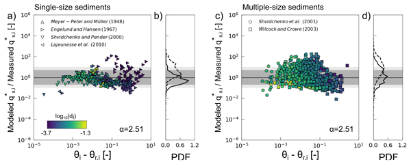
In natural rivers, flow variability and sediment heterogeneity affect how sediment grains are transported. A unique law that predicts the total amount of sediment transportable by a river for a wide range of sediment mixtures and flow conditions exists, but unclear trends remain. Two improvements to this law – a standardized onset of sediment transport and a common reference transport height across all sizes – appear to be critical to having a functional multi-grain-size total sediment load.
Juliette Godet, Pierre Nicolle, Nabil Hocini, Eric Gaume, Philippe Davy, Frederic Pons, Pierre Javelle, Pierre-André Garambois, Dimitri Lague, and Olivier Payrastre
Earth Syst. Sci. Data, 17, 2963–2983, https://doi.org/10.5194/essd-17-2963-2025, https://doi.org/10.5194/essd-17-2963-2025, 2025
Short summary
Short summary
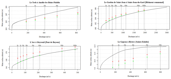
This paper describes a dataset that includes input, output, and validation data for the simulation of flash flood hazards and three specific flash flood events in the French Mediterranean region. This dataset is particularly valuable as flood mapping methods often lack sufficient benchmark data. Additionally, we demonstrate how the hydraulic method we used, named Floodos, produces highly satisfactory results.
Boris Gailleton, Philippe Steer, Philippe Davy, Wolfgang Schwanghart, and Thomas Bernard
Earth Surf. Dynam., 12, 1295–1313, https://doi.org/10.5194/esurf-12-1295-2024, https://doi.org/10.5194/esurf-12-1295-2024, 2024
Short summary
Short summary
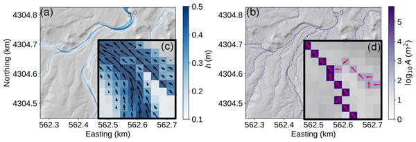
We use cutting-edge algorithms and conceptual simplifications to solve the equations that describe surface water flow. Using quantitative data on rainfall and elevation, GraphFlood calculates river width and depth and approximates erosive power, making it a suitable tool for large-scale hazard management and understanding the relationship between rivers and mountains.
William Kearney, Gina Arnau, Theophil Bringezu, Michael Dietze, Boris Gailleton, Anna-Lena Lamprecht, Kilian Lenz, Richard Ott, Dirk Scherler, Philippe Steer, and Wolfgang Schwanghart
EGUsphere, https://doi.org/10.5194/egusphere-2026-2478, https://doi.org/10.5194/egusphere-2026-2478, 2026
Short summary
Short summary
TopoToolbox is a software package that enables users to analyze maps of the Earth's surface. The newest version of TopoToolbox makes it accessible to more users, makes it easier to integrate TopoToolbox with other software used to study the Earth's surface and establishes a new development process to ensure that TopoToolbox continues to meet the needs of its community of users. We present a series of examples to demonstrate how users can incorporate the new TopoToolbox version into their work.
Julius Jara-Muñoz, Jürgen Mey, Roland Freisleben, Daniel Melnick, Markus Weiss, Patricio Winckler, Chrystelle Mavoungou, and Manfred R. Strecker
Earth Surf. Dynam., 14, 291–311, https://doi.org/10.5194/esurf-14-291-2026, https://doi.org/10.5194/esurf-14-291-2026, 2026
Short summary
Short summary
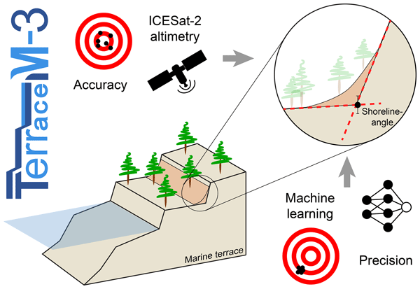
Coastal areas are vulnerable to sea-level rise and earthquakes. Understanding past changes requires precise deformation estimates. Marine terraces record sea-level and tectonic histories but mapping them has relied on subjective criteria. TerraceM-3 introduces standardized workflows and a machine-learning-based approach that, combined with ICESat-2 altimetry, enhances the accuracy and reproducibility of marine terrace mapping.

Nazaré Suziane Soares, Carlos Alexandre Gomes Costa, Till Francke, Christian Mohr, Wolfgang Schwanghart, and Pedro Henrique Augusto Medeiros
Hydrol. Earth Syst. Sci., 30, 849–875, https://doi.org/10.5194/hess-30-849-2026, https://doi.org/10.5194/hess-30-849-2026, 2026
Short summary
Short summary
We use drone surveys to map river intermittency in reaches and classify them into "Wet", "Transition", "Dry" or "Not Determined". We train Random Forest models with 40 candidate predictors, and select altitude, drainage area, distance from dams and dynamic predictors. We separate different models based on dynamic predictors: satellite indices (a) and (b); or (c) antecedent precipitation index (30 days). Model (a) is the most successful in simulating intermittency both temporally and spatially.
Marine Le Minor, Dimitri Lague, Jamie Howarth, and Philippe Davy
Earth Surf. Dynam., 13, 1229–1248, https://doi.org/10.5194/esurf-13-1229-2025, https://doi.org/10.5194/esurf-13-1229-2025, 2025
Short summary
Short summary
In natural rivers, flow variability and sediment heterogeneity affect how sediment grains are transported. A unique law that predicts the total amount of sediment transportable by a river for a wide range of sediment mixtures and flow conditions exists, but unclear trends remain. Two improvements to this law – a standardized onset of sediment transport and a common reference transport height across all sizes – appear to be critical to having a functional multi-grain-size total sediment load.
Juliette Godet, Pierre Nicolle, Nabil Hocini, Eric Gaume, Philippe Davy, Frederic Pons, Pierre Javelle, Pierre-André Garambois, Dimitri Lague, and Olivier Payrastre
Earth Syst. Sci. Data, 17, 2963–2983, https://doi.org/10.5194/essd-17-2963-2025, https://doi.org/10.5194/essd-17-2963-2025, 2025
Short summary
Short summary
This paper describes a dataset that includes input, output, and validation data for the simulation of flash flood hazards and three specific flash flood events in the French Mediterranean region. This dataset is particularly valuable as flood mapping methods often lack sufficient benchmark data. Additionally, we demonstrate how the hydraulic method we used, named Floodos, produces highly satisfactory results.
Boris Gailleton, Philippe Steer, Philippe Davy, Wolfgang Schwanghart, and Thomas Bernard
Earth Surf. Dynam., 12, 1295–1313, https://doi.org/10.5194/esurf-12-1295-2024, https://doi.org/10.5194/esurf-12-1295-2024, 2024
Short summary
Short summary
We use cutting-edge algorithms and conceptual simplifications to solve the equations that describe surface water flow. Using quantitative data on rainfall and elevation, GraphFlood calculates river width and depth and approximates erosive power, making it a suitable tool for large-scale hazard management and understanding the relationship between rivers and mountains.
Wolfgang Schwanghart, Ankit Agarwal, Kristen Cook, Ugur Ozturk, Roopam Shukla, and Sven Fuchs
Nat. Hazards Earth Syst. Sci., 24, 3291–3297, https://doi.org/10.5194/nhess-24-3291-2024, https://doi.org/10.5194/nhess-24-3291-2024, 2024
Short summary
Short summary
The Himalayan landscape is particularly susceptible to extreme events, which interfere with increasing populations and the expansion of settlements and infrastructure. This preface introduces and summarizes the nine papers that are part of the special issue,
Estimating and predicting natural hazards and vulnerabilities in the Himalayan region.
Jürgen Mey, Ravi Kumar Guntu, Alexander Plakias, Igo Silva de Almeida, and Wolfgang Schwanghart
Nat. Hazards Earth Syst. Sci., 24, 3207–3223, https://doi.org/10.5194/nhess-24-3207-2024, https://doi.org/10.5194/nhess-24-3207-2024, 2024
Short summary
Short summary
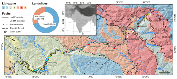
The Himalayan road network links remote areas, but fragile terrain and poor construction lead to frequent landslides. This study on the NH-7 in India's Uttarakhand region analyzed 300 landslides after heavy rainfall in 2022 . Factors like slope, rainfall, rock type and road work influence landslides. The study's model predicts landslide locations for better road maintenance planning, highlighting the risk from climate change and increased road use.
Sebastian Vogel, Katja Emmerich, Ingmar Schröter, Eric Bönecke, Wolfgang Schwanghart, Jörg Rühlmann, Eckart Kramer, and Robin Gebbers
SOIL, 10, 321–333, https://doi.org/10.5194/soil-10-321-2024, https://doi.org/10.5194/soil-10-321-2024, 2024
Short summary
Short summary
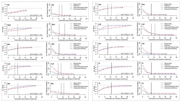
To rapidly obtain high-resolution soil pH data, pH sensors can measure the pH value directly in the field under the current soil moisture (SM) conditions. The influence of SM on pH and on its measurement quality was studied. An SM increase causes a maximum pH increase of 1.5 units. With increasing SM, the sensor pH value approached the standard pH value measured in the laboratory. Thus, at high soil moisture, calibration of the sensor pH values to the standard pH value is negligible.
Anna-Maartje de Boer, Wolfgang Schwanghart, Jürgen Mey, Basanta Raj Adhikari, and Tony Reimann
Geochronology, 6, 53–70, https://doi.org/10.5194/gchron-6-53-2024, https://doi.org/10.5194/gchron-6-53-2024, 2024
Short summary
Short summary
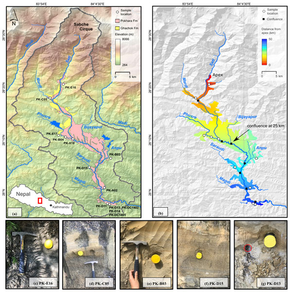
This study tested the application of single-grain feldspar luminescence for dating and reconstructing sediment dynamics of an extreme mass movement event in the Himalayan mountain range. Our analysis revealed that feldspar signals can be used to estimate the age range of the deposits if the youngest subpopulation from a sample is retrieved. The absence of clear spatial relationships with our bleaching proxies suggests that sediments were transported under extremely limited light exposure.
Jens M. Turowski, Gunnar Pruß, Anne Voigtländer, Andreas Ludwig, Angela Landgraf, Florian Kober, and Audrey Bonnelye
Earth Surf. Dynam., 11, 979–994, https://doi.org/10.5194/esurf-11-979-2023, https://doi.org/10.5194/esurf-11-979-2023, 2023
Short summary
Short summary
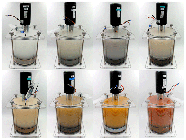
Rivers can cut into rocks, and their strength modulates the river's erosion rates. Yet, which properties of the rock control its response to erosive action is poorly understood. Here, we describe parallel experiments to measure rock erosion rates under fluvial impact erosion and the rock's geotechnical properties such as fracture strength, elasticity, and density. Erosion rates vary over a factor of a million between different rock types. We use the data to improve current theory.
Jürgen Mey, Wolfgang Schwanghart, Anna-Maartje de Boer, and Tony Reimann
Geochronology, 5, 377–389, https://doi.org/10.5194/gchron-5-377-2023, https://doi.org/10.5194/gchron-5-377-2023, 2023
Short summary
Short summary
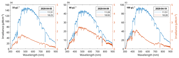
This study presents the results of an outdoor flume experiment to evaluate the effect of turbidity on the bleaching of fluvially transported sediment. Our main conclusions are that even small amounts of sediment lead to a substantial change in the intensity and frequency distribution of light within the suspension and that flow turbulence is an important prerequisite for bleaching grains during transport.
Monika Pfau, Georg Veh, and Wolfgang Schwanghart
The Cryosphere, 17, 3535–3551, https://doi.org/10.5194/tc-17-3535-2023, https://doi.org/10.5194/tc-17-3535-2023, 2023
Short summary
Short summary
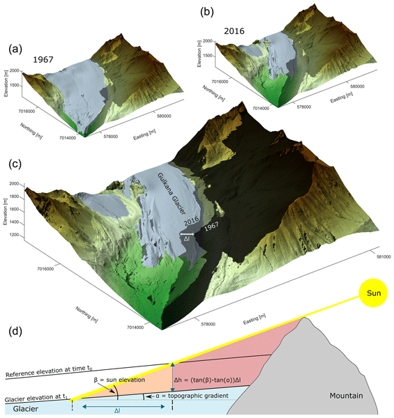
Cast shadows have been a recurring problem in remote sensing of glaciers. We show that the length of shadows from surrounding mountains can be used to detect gains or losses in glacier elevation.
Denis Cohen, Guillaume Jouvet, Thomas Zwinger, Angela Landgraf, and Urs H. Fischer
E&G Quaternary Sci. J., 72, 189–201, https://doi.org/10.5194/egqsj-72-189-2023, https://doi.org/10.5194/egqsj-72-189-2023, 2023
Short summary
Short summary
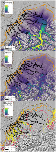
During glacial times in Switzerland, glaciers of the Alps excavated valleys in low-lying regions that were later filled with sediment or water. How glaciers eroded these valleys is not well understood because erosion occurred near ice margins where ice moved slowly and was present for short times. Erosion is linked to the speed of ice and to water flowing under it. Here we present a model that estimates the location of water channels beneath the ice and links these locations to zones of erosion.
Jürgen Mey, Ravi Kumar Guntu, Alexander Plakias, Igo Silva de Almeida, and Wolfgang Schwanghart
Nat. Hazards Earth Syst. Sci. Discuss., https://doi.org/10.5194/nhess-2022-295, https://doi.org/10.5194/nhess-2022-295, 2023
Manuscript not accepted for further review
Short summary
Short summary
The current socioeconomic development in the Himalayan region leads to a rapid expansion of the road network and an increase in the exposure to landslides. Our study along the NH-7 demonstrates the scale of this challenge as we detect more than one partially or fully road-blocking landslide per road kilometer. We identify the main controlling variables, i.e. slope angle, rainfall amount and lithology. As our approach uses a minimum of data, it can be extended to more complicated road networks.
Cited articles
Auel, C., Albayrak, I., Sumi, T., and Boes, R. M.: Sediment transport in high-speed flows over a fixed bed: 2. Particle impacts and abrasion prediction, Earth Surf. Proc. Land., 42, 1384–1396, https://doi.org/10.1002/esp.4132, 2017.
Bagnold, R. A.: An approach to the sediment transport problem from general physics, U.S. Geological Survey Professional Paper 422, I1–I37, https://doi.org/10.3133/pp422I, 1966.
Beaumont, C., Fullsack, P., and Hamilton, J.: Erosional control of active compressional orogens, in: Thrust Tectonics, edited by: McClay, K. R., Chapman and Hall, New York, 1–18, https://doi.org/10.1007/978-94-011-3066-0_1, 1992.
Beer, A. R. and Lamb, M. P.: Abrasion regimes in fluvial bedrock incision, Geology, 49, 682–386, https://doi.org/10.1130/g48466.1, 2021.
Chatanantavet, P. and Parker, G.: Experimental study of bedrock channel alluviation under varied sediment supply and hydraulic conditions, Water Resour. Res., 44, W12446, https://doi.org/10.1029/2007wr006581, 2008.
Chatanantavet, P., Whipple, K. X., Adams, M., and Lamb, M. P.: Experimental study on coarse-grain saltation dynamics in bedrock channels, J. Geophys. Res.-Earth, https://doi.org/10.1002/jgrf.20053, 2013.
Croissant, T., Lague, D., Steer, P., and Davy, P.: Rapid post-seismic landslide evacuation boosted by dynamic river width, Nat. Geosci., 10, 680–684, https://doi.org/10.1038/ngeo3005, 2017a.
Croissant, T., Lague, D., Davy, P., Davies, T., and Steer, P.: A precipiton-based approach to model hydro-sedimentary hazards induced by large sediment supplies in alluvial fans, Earth Surf. Proc. Land., 42, 2054–2067, https://doi.org/10.1002/esp.4171, 2017b.
Davy, P.: Lift or impact: modelling bedrock incision coupled with sediment dynamics, Zenodo [data set], https://doi.org/10.5281/zenodo.19886403, 2026.
Davy, P. and Lague, D.: Fluvial erosion/transport equation of landscape evolution models revisited, J. Geophys. Res., 114, 1–16, https://doi.org/10.1029/2008jf001146, 2009.
Davy, P., Croissant, T., and Lague, D.: A precipiton method to calculate river hydrodynamics, with applications to flood prediction, landscape evolution models, and braiding instabilities, J. Geophys. Res.-Earth, 122, 1491–1512, https://doi.org/10.1002/2016jf004156, 2017.
Demiral, D., Albayrak, I., Turowski, J. M., and Boes, R. M.: Hydro-abrasion processes and modelling at hydraulic structures and steep bedrock rivers: 2. Hydro-abrasion model development and application, J. Hydro-Environ. Res., 64, 100690, https://doi.org/10.1016/j.jher.2025.100690, 2026.
Engelund, F. and Hansen, E.: A monograph on sediment transport in alluvial streams, Teknisk forlag Copenhagen, https://fr.scribd.com/doc/246147566/Engelund-Hansen-1967 (last access: August 2026), 1967.
Fernandez Luque, R. and Van Beek, R.: Erosion And Transport Of Bed-Load Sediment, J. Hydraul. Res., 14, 127–144, https://doi.org/10.1080/00221687609499677, 1976.
Foley, M. G.: Bed-rock incision by streams, Geol. Soc. Am. Bull., 91, 2189–2213, 1980.
Fraccarollo, L. and Rosatti, G.: Lateral bed load experiments in a flume with strong initial transversal slope, in sub- and supercritical conditions, Water Resour. Res., 45, https://doi.org/10.1029/2008WR007246, 2009.
Fuller, T. K., Gran, K. B., Sklar, L. S., and Paola, C.: Lateral erosion in an experimental bedrock channel: The influence of bed roughness on erosion by bed load impacts, J. Geophys. Res.-Earth, 121, 1084–1105, https://doi.org/10.1002/2015JF003728, 2016.
Gabel, V., Tucker, G. E., and Campforts, B.: A mathematical model for bedrock incision in near-threshold gravel-bed rivers, Earth Surf. Proc. Land., 49, 4168–4186, 2024.
Gilbert, G.: Report on the geology of the Henry Mountains: US geographical and geological survey of the Rocky Mountain region, Washington, DC, US Government Printing, https://pubs.usgs.gov/publication/70039916 (last access: August 2026), 1877.
Heitzmann, P.: The Rhine Falls, in: Landscapes and Landforms of Switzerland, edited by: Reynard, E., Springer International Publishing, Cham, 337–350, https://doi.org/10.1007/978-3-030-43203-4_23, 2021.
Hinderer, M., Kastowski, M., Kamelger, A., Bartolini, C., and Schlunegger, F.: River loads and modern denudation of the Alps – A review, Earth-Sci. Rev., 118, 11-44, https://doi.org/10.1016/j.earscirev.2013.01.001, 2013.
Hocini, N., Payrastre, O., Bourgin, F., Gaume, E., Davy, P., Lague, D., Poinsignon, L., and Pons, F.: Performance of automated methods for flash flood inundation mapping: a comparison of a digital terrain model (DTM) filling and two hydrodynamic methods, Hydrol. Earth Syst. Sci., 25, 2979–2995, https://doi.org/10.5194/hess-25-2979-2021, 2021.
Hodge, R. A. and Hoey, T. B.: Upscaling from grain-scale processes to alluviation in bedrock channels using a cellular automaton model, J. Geophys. Res., 117, F01017, https://doi.org/10.1029/2011jf002145, 2012.
Hofmann, F.: Geologie und Entstehungsgeschichte des Rheinfalls, Neujahrsblatt der Naturforschenden Gesellschaft Schaffhausen, 39, 10–20, https://doi.org/10.5169/SEALS-584666, 1987.
Huang, H. Q.: Reformulation of the bed load equation of Meyer-Peter and Müller in light of the linearity theory for alluvial channel flow, Water Resour. Res., 46, W09533, https://doi.org/10.1029/2009wr008974, 2010.
Ikeda, S.: Lateral bed load transport on side slopes, J. Hydr. Eng. Div., 108, 1369–1373, 1982.
Inoue, T., Izumi, N., Shimizu, Y., and Parker, G.: Interaction among alluvial cover, bed roughness, and incision rate in purely bedrock and alluvial-bedrock channel, J. Geophys. Res.-Earth, 119, 2123–2146, https://doi.org/10.1002/2014JF003133, 2014.
Inoue, T., Hiramatsu, Y., and Johnson, J. P.: Morphological and sediment supply controls on lateral bedrock channel erosion, Geophys. Res. Lett., 52, e2024GL113436, https://doi.org/10.1029/2024GL113436, 2025.
Johnson, J. P. L.: A surface roughness model for predicting alluvial cover and bed load transport rate in bedrock channels, J. Geophys. Res.-Earth, 119, 2147–2173, https://doi.org/10.1002/2013JF003000, 2014.
Lamb, M. P., Dietrich, W. E., and Sklar, L. S.: A model for fluvial bedrock incision by impacting suspended and bed load sediment, J. Geophys. Res.-Earth, 113, https://doi.org/10.1029/2007JF000915, 2008.
Lamb, M. P., Finnegan, N. J., Scheingross, J. S., and Sklar, L. S.: New insights into the mechanics of fluvial bedrock erosion through flume experiments and theory, Geomorphology, 244, 33–55, https://doi.org/10.1016/j.geomorph.2015.03.003, 2015.
Le Minor, M., Davy, P., Howarth, J., and Lague, D.: Multi Grain-Size Total Sediment Load Model Based on the Disequilibrium Length, J. Geophys. Res.-Earth, 127, e2021JF006546, https://doi.org/10.1029/2021JF006546, 2022.
Li, T., Fuller, T. K., Sklar, L. S., Gran, K. B., and Venditti, J. G.: A Mechanistic Model for Lateral Erosion of Bedrock Channel Banks by Bedload Particle Impacts, J. Geophys. Res.-Earth, 125, e2019JF005509, https://doi.org/10.1029/2019JF005509, 2020.
Li, T. A., Venditti, J. G., and Sklar, L. S.: An Analytical Model for Lateral Erosion From Saltating Bedload Particle Impacts, J. Geophys. Res.-Earth, 126, e2020JF006061, https://doi.org/10.1029/2020JF006061, 2021.
Litwin Miller, K. and Jerolmack, D.: Controls on the rates and products of particle attrition by bed-load collisions, Earth Surf. Dynam., 9, 755–770, https://doi.org/10.5194/esurf-9-755-2021, 2021.
Meyer-Peter, E. and Müller, R.: Formulas for bedload transport, Proceedings of the 2nd Meeting of the International Association for Hydraulic Structures Research, Stockholm, https://repository.tudelft.nl/record/uuid:4fda9b61-be28-4703-ab06-43cdc2a21bd7 (last access: August 2026), 1948.
Mishra, J., Inoue, T., Shimizu, Y., Sumner, T., and Nelson, J. M.: Consequences of Abrading Bed Load on Vertical and Lateral Bedrock Erosion in a Curved Experimental Channel, J. Geophys. Res.-Earth, 123, 3147–3161, https://doi.org/10.1029/2017jf004387, 2018.
Nelson, P. A. and Seminara, G.: Modeling the evolution of bedrock channel shape with erosion from saltating bed load, Geophys. Res. Lett., 38, https://doi.org/10.1029/2011GL048628, 2011.
Nelson, P. A. and Seminara, G.: A theoretical framework for the morphodynamics of bedrock channels, Geophys. Res. Lett., 39, https://doi.org/10.1029/2011GL050806, 2012.
Nicholas, A. P.: Modelling the continuum of river channel patterns, Earth Surf. Proc. Land., 38, 1187–1196, https://doi.org/10.1002/esp.3431, 2013.
Parker, G.: Lateral bed load transport on side slopes, J. Hydraul. Eng., 110, 197–199, 1984a.
Parker, G.: Discussion of “Lateral Bed Load Transport on Side Slopes” by Syunsuke Ikeda (November, 1982), J. Hydraul. Eng., 110, 197–199, https://doi.org/10.1061/(ASCE)0733-9429(1984)110:2(197), 1984b.
Parker, G., Klingeman, P. C., and McLean, D. G.: Bedload and Size Distribution in Paved Gravel-Bed Streams, J. Hydr. Eng. Div., 108, 544–571, https://doi.org/10.1061/JYCEAJ.0005854, 1982.
Pietsch, J. and Jordan, P.: Digitales Höhenmodell Basis Quartär der Nordschweiz – Version 2014 und ausgewählte Auswertungen, Nagra, https://www.nagra.ch/en/reports/arbeitsbericht-nab-14-02 (last access: August 2026), 2014.
Scheingross, J. S., Brun, F., Lo, D. Y., Omerdin, K., and Lamb, M. P.: Experimental evidence for fluvial bedrock incision by suspended and bedload sediment, Geology, 42, 523–526, 2014.
Sekine, M. and Parker, G.: Bed-Load Transport on Transverse Slope. I, J. Hydraul. Eng., https://doi.org/10.1061/(ASCE)0733-9429(1992)118:4(513), 1992.
Shobe, C. M., Tucker, G. E., and Barnhart, K. R.: The SPACE 1.0 model: a Landlab component for 2-D calculation of sediment transport, bedrock erosion, and landscape evolution, Geosci. Model Dev., 10, 4577–4604, https://doi.org/10.5194/gmd-10-4577-2017, 2017.
Sklar, L. S. and Dietrich, W. E.: Sediment and rock strength controls on river incision into bedrock, Geology, 29, 1087–1090, 2001.
Sklar, L. S. and Dietrich, W. E.: A mechanistic model for river incision into bedrock by saltating bed load, Water Resour. Res., 40, https://doi.org/10.1029/2003WR002496, 2004.
Sklar, L. S. and Dietrich, W. E.: Correction to “A mechanistic model for river incision into bedrock by saltating bed load”, Water Resour. Res., 48, https://doi.org/10.1029/2012WR012267, 2012.
Talmon, A., Struiksma, N., and Van Mierlo, M.: Laboratory measurements of the direction of sediment transport on transverse alluvial-bed slopes, J. Hydraul. Res., 33, 495–517, 1995.
Turowski, J. M. and Hodge, R.: A probabilistic framework for the cover effect in bedrock erosion, Earth Surf. Dynam., 5, 311–330, https://doi.org/10.5194/esurf-5-311-2017, 2017.
Turowski, J. M., Lague, D., and Hovius, N.: Cover effect in bedrock abrasion: A new derivation and its implications for the modeling of bedrock channel morphology, J. Geophys. Res.-Earth, 112, F04006, https://doi.org/10.1029/2006JF000697, 2007.
Turowski, J. M., Rickenmann, D., and Dadson, S. J.: The partitioning of the total sediment load of a river into suspended load and bedload: a review of empirical data, Sedimentology, 57, 1126–1146, https://doi.org/10.1111/j.1365-3091.2009.01140.x, 2010.
Turowski, J. M., Pruß, G., Voigtländer, A., Ludwig, A., Landgraf, A., Kober, F., and Bonnelye, A.: Geotechnical controls on erodibility in fluvial impact erosion, Earth Surf. Dynam., 11, 979–994, https://doi.org/10.5194/esurf-11-979-2023, 2023.
van Rijn, L.: Sediment Transport, Part I: Bed Load Transport, J. Hydraul. Eng., 110, 1431–1456, https://doi.org/10.1061/(ASCE)0733-9429(1984)110:10(1431), 1984.
Wong, M. and Parker, G.: Reanalysis and correction of bed-load relation of Meyer-Peter and Müller using their own database, J. Hydraul. Eng., 132, 1159–1168, 2006.
Yang, S.-Q., Yu, J.-X., and Wang, Y.-Z.: Estimation of diffusion coefficients, lateral shear stress, and velocity in open channels with complex geometry, Water Resour. Res., 40, https://doi.org/10.1029/2003wr002818, 2004.
Short summary
The impact of sediment grains on the riverbed is a key driver of bedrock erosion yet is rarely included in studies of landscape evolution. We propose an equation to address this issue by considering the distinction between grain lift and grain impact. We solved and analysed these equations for simple cases, such as the downstream evolution of a riverbed, and implemented them in a numerical code that simulated the retreat of a knickpoint.
The impact of sediment grains on the riverbed is a key driver of bedrock erosion yet is rarely...


