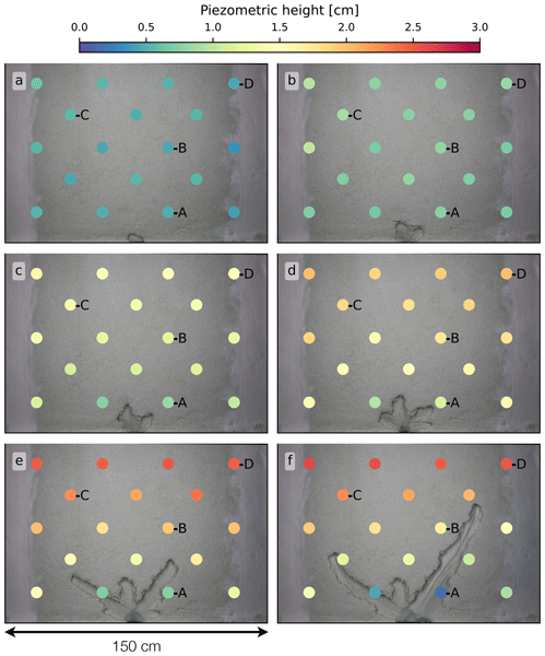
When groundwater emerges at the surface with sufficient force, it erodes the landscape and forms river networks. We reproduce this process in laboratory experiments to investigate the interplay between network growth and the resulting modification of surrounding groundwater flow. We present a numerical method which reconstructs the groundwater flow in the experimental aquifer. We find that groundwater converges toward channel tips, explaining why network growth occurs preferentially at the tips.
David Mair, Guillaume Witz, Ariel Do Prado, Philippos Garefalakis, Amanda Wild, Fanny Ville, Bennet Schuster, Michael Horn, Jürgen Österle, Stefano C. Fabbri, Camille Litty, Stefan Achleitner, Sebastian Leistner, Clemens Hiller, and Fritz Schlunegger
This study introduces an updated image analysis framework for automatically identifying and measuring sediment grains in various types of images and scans. We employ a high-performing segmentation approach for a wide range of geoscientific data, using carefully curated ground truth data. The method achieves higher accuracy and more consistent measurements than existing approaches. The data and algorithm are openly available and provided in a user-friendly way.
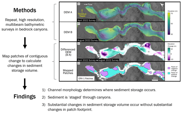
Sediment cover in bedrock rivers can protect or expose bedrock to incision, yet little is known about sediment storage dynamics in deep canyons since it is difficult to observe the bed. We use repeat bed surveys to identify changes in storage, observing vertical changes up to 15 m. Local flow and channel shape determine where storage occurs, yet storage can vary plenty over a single footprint. The location and timing of sediment inputs to the river influence whether storage is gained or lost.