
Articles | Volume 14, issue 4
https://doi.org/10.5194/esurf-14-575-2026
© Author(s) 2026. This work is distributed under
the Creative Commons Attribution 4.0 License.
the Creative Commons Attribution 4.0 License.
https://doi.org/10.5194/esurf-14-575-2026
© Author(s) 2026. This work is distributed under
the Creative Commons Attribution 4.0 License.
the Creative Commons Attribution 4.0 License.
Research article
| Highlight paper
| 
29 Jul 2026
Research article | Highlight paper |
| 29 Jul 2026
| 29 Jul 2026
Valley longitudinal profiles record the fluvial landscape evolution and geological structure of the Gamburtsev Subglacial Mountains, East Antarctica
Guy J. G. Paxman
CORRESPONDING AUTHOR

Department of Geography, Durham University, Durham, DH1 3LE, United Kingdom
Fiona J. Clubb
Department of Geography, Durham University, Durham, DH1 3LE, United Kingdom
Stewart S. R. Jamieson
Department of Geography, Durham University, Durham, DH1 3LE, United Kingdom
Alexander L. Densmore
Department of Geography, Durham University, Durham, DH1 3LE, United Kingdom
Related authors
Natalie J. Burls, Nicky M. Wright, R. Paul Acosta, Catherine D. Bradshaw, Edward Gasson, Lennert B. Stap, Gilles Ramstein, Anna Ruth W. Halberstadt, Agatha M. De Boer, Funda Akgün, David J. Cantrill, Manuel Casas-Gallego, Nela Doláková, Boglarka Erdei, Alex Farnsworth, Sarah Feakins, Ran Feng, Tamara Fletcher, Frédéric Fluteau, J. A. Mattias Green, Anna S. von der Heydt, Matthew Huber, David K. Hutchinson, Dimiter Ivanov, Mine Sezgül Kayseri-Özer, Gregor Knorr, Marianna Kováčová, Caroline H. Lear, Allegra N. LeGrande, Shufeng Li, Xiaoqing Liu, Daniel J. Lunt, Katrin Meissner, Yunfa Miao, Trusha J. Naik, Javier B. Navarro, Joseph B. Novak, Diana Ochoa, Guy J.G. Paxman, Matthew J. Pound, James W. B. Rae, Tammo Reichgelt, Martin Renoult, Francesca Sangiorgi, Anta-Clarisse Sarr, Diane Segalla, Pierre Sepulchre, Amelia Shevenell, Sebastian Steinig, Eivind Straume, Caroline A. E. Strömberg, Clay Tabor, Torsten Utescher, Julia E. Weiffenbach, Elżbieta Worobiec, Yurui Zhang, Feng Zhu, Jiang Zhu, Alexandra Auderset, Florence Colleoni, Aisling Dolan, Rachel Havranek, Ann Holbourn, Nicholas Herold, Daeun Lee, James W. Marschalek, Bryce Mitsunaga, Sevi Modestou, Lina Perez-Angel, Mae Saslaw, Sinda Sosdian, Elena Stiles, Yong Sun, Ning Tan, Zhongshi Zhang, and Yan Zhao
EGUsphere, https://doi.org/10.5194/egusphere-2026-3595, https://doi.org/10.5194/egusphere-2026-3595, 2026
This preprint is open for discussion and under review for Geoscientific Model Development (GMD).
Short summary
Short summary
Simulating warm paleoclimates increases our understanding of the mechanisms that drive climatic change and tipping points. The Miocene Epoch, specifically the Miocene Climatic Optimum, has been identified as a particularly valuable past warm climate to simulate, meriting the design of a coordinated Miocene Model Intercomparison Project. Here we synthesize the latest available literature and present the experimental design for coordinated Miocene simulations and sensitivity studies.
Neil Ross, Rebecca J. Sanderson, Bernd Kulessa, Martin Siegert, Guy J. G. Paxman, Keir A. Nichols, Matthew R. Siegfried, Stewart S. R. Jamieson, Michael J. Bentley, Tom A. Jordan, Christine L. Batchelor, David Small, Olaf Eisen, Kate Winter, Robert G. Bingham, S. Louise Callard, Rachel Carr, Christine F. Dow, Helen A. Fricker, Emily Hill, Benjamin H. Hills, Coen Hofstede, Hafeez Jeofry, Felipe Napoleoni, and Wilson Sauthoff
The Cryosphere, 20, 3705–3737, https://doi.org/10.5194/tc-20-3705-2026, https://doi.org/10.5194/tc-20-3705-2026, 2026
Short summary
Short summary
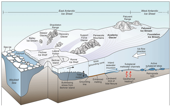
We review research about a group of fast-flowing Antarctic ice streams, the Foundation-Patuxent-Academy System. Previously, we knew little about how these ice streams flow, how they interact with each other and the ocean, what their geological history was, and how they might evolve in a warming world. By reviewing existing research, we have identified the future research needed to determine how these ice streams function, and how they might contribute to future global sea level rise.
Charlotte M. Carter, Michael J. Bentley, Stewart S. R. Jamieson, Guy J. G. Paxman, Tom A. Jordan, Julien A. Bodart, Neil Ross, and Felipe Napoleoni
The Cryosphere, 18, 2277–2296, https://doi.org/10.5194/tc-18-2277-2024, https://doi.org/10.5194/tc-18-2277-2024, 2024
Short summary
Short summary
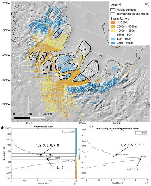
We use radio-echo sounding data to investigate the presence of flat surfaces beneath the Evans–Rutford region in West Antarctica. These surfaces may be what remains of laterally continuous surfaces, formed before the inception of the West Antarctic Ice Sheet, and we assess two hypotheses for their formation. Tectonic structures in the region may have also had a control on the growth of the ice sheet by focusing ice flow into troughs adjoining these surfaces.
Guy J. G. Paxman, Stewart S. R. Jamieson, Aisling M. Dolan, and Michael J. Bentley
The Cryosphere, 18, 1467–1493, https://doi.org/10.5194/tc-18-1467-2024, https://doi.org/10.5194/tc-18-1467-2024, 2024
Short summary
Short summary
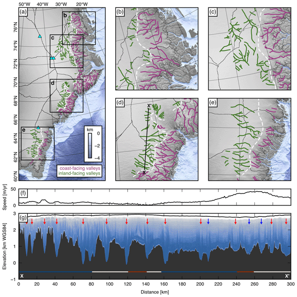
This study uses airborne radar data and satellite imagery to map mountainous topography hidden beneath the Greenland Ice Sheet. We find that the landscape records the former extent and configuration of ice masses that were restricted to areas of high topography. Computer models of ice flow indicate that valley glaciers eroded this landscape millions of years ago when local air temperatures were at least 4 °C higher than today and Greenland’s ice volume was < 10 % of that of the modern ice sheet.
Jiao Chen, Rebecca A. Hodge, Stewart S. R. Jamieson, and Chris R. Stokes
The Cryosphere, 20, 5785–5811, https://doi.org/10.5194/tc-20-5785-2026, https://doi.org/10.5194/tc-20-5785-2026, 2026
Short summary
Short summary
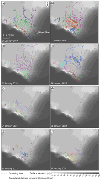
Supraglacial drainage systems mediate meltwater transport over ice shelves and may influence their stability. Our mapping of Nivlisen Ice Shelf from satellite imagery shows significant variation in interannual and seasonal drainage extent. During warm summers, channels become increasingly connected, redistributing meltwater from high to low elevations across the ice shelf. Channel location is controlled by ice shelf structure, and annual extent is correlated with regional air temperature.
Matilda Weatherley, Chris R. Stokes, Stewart S. R. Jamieson, Sindhu Ramanath, and Alessandro Silvano
The Cryosphere, 20, 5509–5532, https://doi.org/10.5194/tc-20-5509-2026, https://doi.org/10.5194/tc-20-5509-2026, 2026
Short summary
Short summary
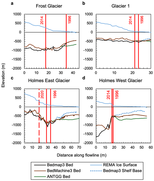
Parts of the East Antarctic Ice Sheet rest on a bed below sea level, making them vulnerable to ice dynamic changes and instability, but few glaciers have been studied in detail. Here we report on glaciers draining into Porpoise Bay, Wilkes Land, overlying the Aurora Subglacial Basin. We find ice surface thinning, grounding line retreat and ice surface velocity increase over recent decades, consistent with warm ocean waters intrusion. This highlights this region's vulnerability to future warming.
Natalie J. Burls, Nicky M. Wright, R. Paul Acosta, Catherine D. Bradshaw, Edward Gasson, Lennert B. Stap, Gilles Ramstein, Anna Ruth W. Halberstadt, Agatha M. De Boer, Funda Akgün, David J. Cantrill, Manuel Casas-Gallego, Nela Doláková, Boglarka Erdei, Alex Farnsworth, Sarah Feakins, Ran Feng, Tamara Fletcher, Frédéric Fluteau, J. A. Mattias Green, Anna S. von der Heydt, Matthew Huber, David K. Hutchinson, Dimiter Ivanov, Mine Sezgül Kayseri-Özer, Gregor Knorr, Marianna Kováčová, Caroline H. Lear, Allegra N. LeGrande, Shufeng Li, Xiaoqing Liu, Daniel J. Lunt, Katrin Meissner, Yunfa Miao, Trusha J. Naik, Javier B. Navarro, Joseph B. Novak, Diana Ochoa, Guy J.G. Paxman, Matthew J. Pound, James W. B. Rae, Tammo Reichgelt, Martin Renoult, Francesca Sangiorgi, Anta-Clarisse Sarr, Diane Segalla, Pierre Sepulchre, Amelia Shevenell, Sebastian Steinig, Eivind Straume, Caroline A. E. Strömberg, Clay Tabor, Torsten Utescher, Julia E. Weiffenbach, Elżbieta Worobiec, Yurui Zhang, Feng Zhu, Jiang Zhu, Alexandra Auderset, Florence Colleoni, Aisling Dolan, Rachel Havranek, Ann Holbourn, Nicholas Herold, Daeun Lee, James W. Marschalek, Bryce Mitsunaga, Sevi Modestou, Lina Perez-Angel, Mae Saslaw, Sinda Sosdian, Elena Stiles, Yong Sun, Ning Tan, Zhongshi Zhang, and Yan Zhao
EGUsphere, https://doi.org/10.5194/egusphere-2026-3595, https://doi.org/10.5194/egusphere-2026-3595, 2026
This preprint is open for discussion and under review for Geoscientific Model Development (GMD).
Short summary
Short summary
Simulating warm paleoclimates increases our understanding of the mechanisms that drive climatic change and tipping points. The Miocene Epoch, specifically the Miocene Climatic Optimum, has been identified as a particularly valuable past warm climate to simulate, meriting the design of a coordinated Miocene Model Intercomparison Project. Here we synthesize the latest available literature and present the experimental design for coordinated Miocene simulations and sensitivity studies.
Neil Ross, Rebecca J. Sanderson, Bernd Kulessa, Martin Siegert, Guy J. G. Paxman, Keir A. Nichols, Matthew R. Siegfried, Stewart S. R. Jamieson, Michael J. Bentley, Tom A. Jordan, Christine L. Batchelor, David Small, Olaf Eisen, Kate Winter, Robert G. Bingham, S. Louise Callard, Rachel Carr, Christine F. Dow, Helen A. Fricker, Emily Hill, Benjamin H. Hills, Coen Hofstede, Hafeez Jeofry, Felipe Napoleoni, and Wilson Sauthoff
The Cryosphere, 20, 3705–3737, https://doi.org/10.5194/tc-20-3705-2026, https://doi.org/10.5194/tc-20-3705-2026, 2026
Short summary
Short summary
We review research about a group of fast-flowing Antarctic ice streams, the Foundation-Patuxent-Academy System. Previously, we knew little about how these ice streams flow, how they interact with each other and the ocean, what their geological history was, and how they might evolve in a warming world. By reviewing existing research, we have identified the future research needed to determine how these ice streams function, and how they might contribute to future global sea level rise.
Aude Lurin, Philippe Steer, Fiona Clubb, and Boris Gailleton
EGUsphere, https://doi.org/10.5194/egusphere-2026-3145, https://doi.org/10.5194/egusphere-2026-3145, 2026
Short summary
Short summary
The dynamics of mountains landscapes is controled by their valley networks. The morphology of valleys, including their width, impacts how they transmit sediments and water and record tectonic or climatic signals. In order to further our understanding of the controls of valley morphology and width, we compare two automatic valley extraction methods in four regions. We then evaluate how valley width and morphology is affected dy drainage area, lithology, and the tectonic and geomorphic setting.
Felipe Napoleoni, Michael J. Bentley, Neil Ross, Stewart S. R. Jamieson, José A. Uribe, Jonathan Oberreuter, Rodrigo Zamora, Andrés Rivera, Andrew M. Smith, Robert G. Bingham, and Kenichi Matsuoka
The Cryosphere, 20, 2793–2824, https://doi.org/10.5194/tc-20-2793-2026, https://doi.org/10.5194/tc-20-2793-2026, 2026
Short summary
Short summary
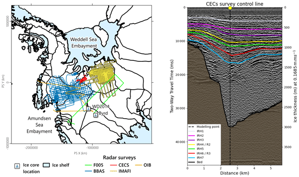
We mapped buried layers inside West Antarctic ice across 13,000 km² near the Amundsen–Weddell divide using radar. Some layers may be up to 17 kyr old. The layers remain well preserved in slow-moving ice but become distorted where ice flows faster. Snowfall has long been greater on one side of the divide, suggesting the ice divide has remained stable for thousands of years. Our study helps connect climate records across West Antarctica and improve models used to predict future ice-sheet change.
Anya H. Towers, Mikael Attal, Simon M. Mudd, and Fiona J. Clubb
Earth Surf. Dynam., 14, 95–113, https://doi.org/10.5194/esurf-14-95-2026, https://doi.org/10.5194/esurf-14-95-2026, 2026
Short summary
Short summary
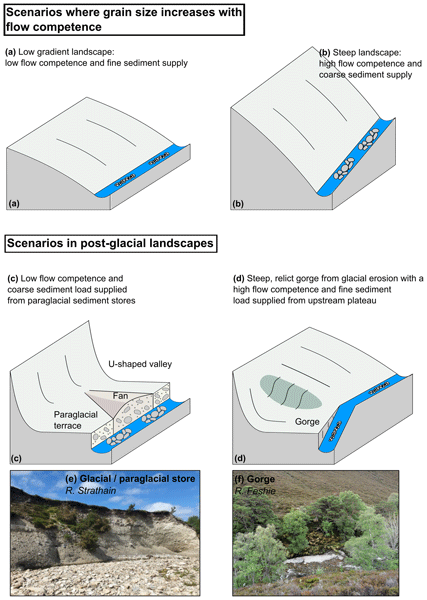
We explore controls on channel sediment characteristics in post-glacial landscapes. In contrast to other studies that have focused on landscapes with little glacial influence, we find no apparent controls. We propose that Scotland's post-glacial legacy drives the lack of sedimentological trends, and that changes in landscape morphology and sediment sources caused by glacial processes lead to a decoupling between fluvial sediment grain size and environmental variables.
Holly Wytiahlowsky, Chris R. Stokes, Rebecca A. Hodge, Caroline C. Clason, and Stewart S. R. Jamieson
The Cryosphere, 19, 6461–6482, https://doi.org/10.5194/tc-19-6461-2025, https://doi.org/10.5194/tc-19-6461-2025, 2025
Short summary
Short summary
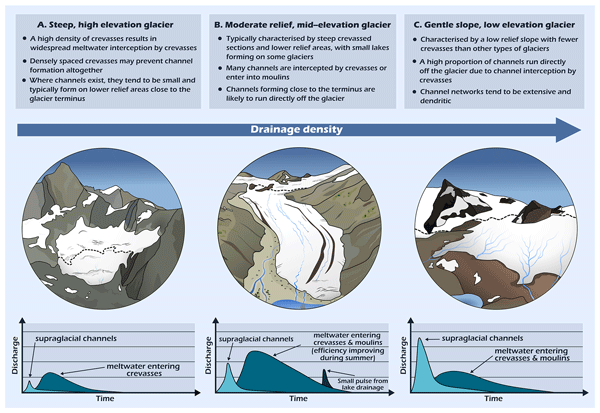
Channels on glaciers are important due to their role in transporting glacial meltwater into downstream river catchments. These channels have received little research in mountain environments. We manually mapped <2000 channels to determine their distribution and characteristics across 285 glaciers in Switzerland. We find that channels are mostly commonly found on low-elevation glaciers with gentle slopes and few crevasses. Most channels run off the glacier, but 20 % enter the glacier.
Maximillian Van Wyk de Vries, Alexandre Dunant, Amy L. Johnson, Erin L. Harvey, Sihan Li, Katherine Arrell, Jeevan Baniya, Dipak Basnet, Gopi K. Basyal, Nyima Dorjee Bhotia, Simon J. Dadson, Alexander L. Densmore, Tek Bahadur Dong, Mark E. Kincey, Katie Oven, Anuradha Puri, and Nick J. Rosser
Nat. Hazards Earth Syst. Sci., 25, 1937–1942, https://doi.org/10.5194/nhess-25-1937-2025, https://doi.org/10.5194/nhess-25-1937-2025, 2025
Short summary
Short summary
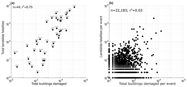
Mapping exposure to landslides is necessary to mitigate risk and reduce vulnerability. In this study, we show that there is a poor correlation between building damage and deaths from landslides, such that the deadliest landslides do not always destroy the most buildings and vice versa. This has important implications for our management of landslide risk.
Alexandre Dunant, Tom R. Robinson, Alexander L. Densmore, Nick J. Rosser, Ragindra Man Rajbhandari, Mark Kincey, Sihan Li, Prem Raj Awasthi, Max Van Wyk de Vries, Ramesh Guragain, Erin Harvey, and Simon Dadson
Nat. Hazards Earth Syst. Sci., 25, 267–285, https://doi.org/10.5194/nhess-25-267-2025, https://doi.org/10.5194/nhess-25-267-2025, 2025
Short summary
Short summary
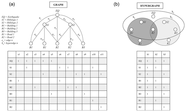
Natural hazards like earthquakes often trigger other disasters, such as landslides, creating complex chains of impacts. We developed a risk model using a mathematical approach called hypergraphs to efficiently measure the impact of interconnected hazards. We showed that it can predict broad patterns of damage to buildings and roads from the 2015 Nepal earthquake. The model's efficiency allows it to generate multiple disaster scenarios, even at a national scale, to support preparedness plans.
Charlotte M. Carter, Michael J. Bentley, Stewart S. R. Jamieson, Guy J. G. Paxman, Tom A. Jordan, Julien A. Bodart, Neil Ross, and Felipe Napoleoni
The Cryosphere, 18, 2277–2296, https://doi.org/10.5194/tc-18-2277-2024, https://doi.org/10.5194/tc-18-2277-2024, 2024
Short summary
Short summary
We use radio-echo sounding data to investigate the presence of flat surfaces beneath the Evans–Rutford region in West Antarctica. These surfaces may be what remains of laterally continuous surfaces, formed before the inception of the West Antarctic Ice Sheet, and we assess two hypotheses for their formation. Tectonic structures in the region may have also had a control on the growth of the ice sheet by focusing ice flow into troughs adjoining these surfaces.
Edmund J. Lea, Stewart S. R. Jamieson, and Michael J. Bentley
The Cryosphere, 18, 1733–1751, https://doi.org/10.5194/tc-18-1733-2024, https://doi.org/10.5194/tc-18-1733-2024, 2024
Short summary
Short summary
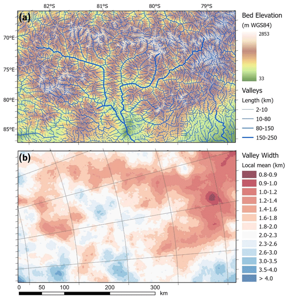
We use the ice surface expression of the Gamburtsev Subglacial Mountains in East Antarctica to map the horizontal pattern of valleys and ridges in finer detail than possible from previous methods. In upland areas, valleys are spaced much less than 5 km apart, with consequences for the distribution of melting at the bed and hence the likelihood of ancient ice being preserved. Automated mapping techniques were tested alongside manual approaches, with a hybrid approach recommended for future work.
Guy J. G. Paxman, Stewart S. R. Jamieson, Aisling M. Dolan, and Michael J. Bentley
The Cryosphere, 18, 1467–1493, https://doi.org/10.5194/tc-18-1467-2024, https://doi.org/10.5194/tc-18-1467-2024, 2024
Short summary
Short summary
This study uses airborne radar data and satellite imagery to map mountainous topography hidden beneath the Greenland Ice Sheet. We find that the landscape records the former extent and configuration of ice masses that were restricted to areas of high topography. Computer models of ice flow indicate that valley glaciers eroded this landscape millions of years ago when local air temperatures were at least 4 °C higher than today and Greenland’s ice volume was < 10 % of that of the modern ice sheet.
Maximillian Van Wyk de Vries, Sihan Li, Katherine Arrell, Jeevan Baniya, Dipak Basnet, Gopi K. Basyal, Nyima Dorjee Bhotia, Alexander L. Densmore, Tek Bahadur Dong, Alexandre Dunant, Erin L. Harvey, Ganesh K. Jimee, Mark E. Kincey, Katie Oven, Sarmila Paudyal, Dammar Singh Pujara, Anuradha Puri, Ram Shrestha, Nick J. Rosser, and Simon J. Dadson
EGUsphere, https://doi.org/10.5194/egusphere-2024-397, https://doi.org/10.5194/egusphere-2024-397, 2024
Preprint archived
Short summary
Short summary
This study focuses on understanding soil moisture, a key factor for evaluating hillslope stability and landsliding. In Nepal, where landslides are common, we used a computer model to better understand how rapidly soil dries out after the monsoon season. We calibrated the model using field data and found that, by adjusting soil properties, we could predict moisture levels more accurately. This helps understand where landslides might occur, even where direct measurements are not possible.
Hannah J. Picton, Chris R. Stokes, Stewart S. R. Jamieson, Dana Floricioiu, and Lukas Krieger
The Cryosphere, 17, 3593–3616, https://doi.org/10.5194/tc-17-3593-2023, https://doi.org/10.5194/tc-17-3593-2023, 2023
Short summary
Short summary
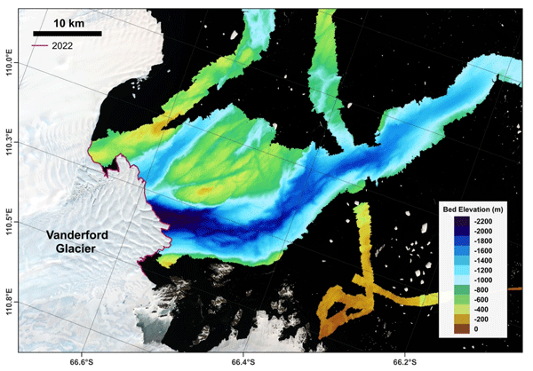
This study provides an overview of recent ice dynamics within Vincennes Bay, Wilkes Land, East Antarctica. This region was recently discovered to be vulnerable to intrusions of warm water capable of driving basal melt. Our results show extensive grounding-line retreat at Vanderford Glacier, estimated at 18.6 km between 1996 and 2020. This supports the notion that the warm water is able to access deep cavities below the Vanderford Ice Shelf, potentially making Vanderford Glacier unstable.
Michael J. Bentley, James A. Smith, Stewart S. R. Jamieson, Margaret R. Lindeman, Brice R. Rea, Angelika Humbert, Timothy P. Lane, Christopher M. Darvill, Jeremy M. Lloyd, Fiamma Straneo, Veit Helm, and David H. Roberts
The Cryosphere, 17, 1821–1837, https://doi.org/10.5194/tc-17-1821-2023, https://doi.org/10.5194/tc-17-1821-2023, 2023
Short summary
Short summary
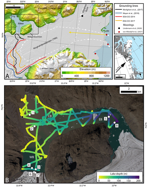
The Northeast Greenland Ice Stream is a major outlet of the Greenland Ice Sheet. Some of its outlet glaciers and ice shelves have been breaking up and retreating, with inflows of warm ocean water identified as the likely reason. Here we report direct measurements of warm ocean water in an unusual lake that is connected to the ocean beneath the ice shelf in front of the 79° N Glacier. This glacier has not yet shown much retreat, but the presence of warm water makes future retreat more likely.
James A. Smith, Louise Callard, Michael J. Bentley, Stewart S. R. Jamieson, Maria Luisa Sánchez-Montes, Timothy P. Lane, Jeremy M. Lloyd, Erin L. McClymont, Christopher M. Darvill, Brice R. Rea, Colm O'Cofaigh, Pauline Gulliver, Werner Ehrmann, Richard S. Jones, and David H. Roberts
The Cryosphere, 17, 1247–1270, https://doi.org/10.5194/tc-17-1247-2023, https://doi.org/10.5194/tc-17-1247-2023, 2023
Short summary
Short summary
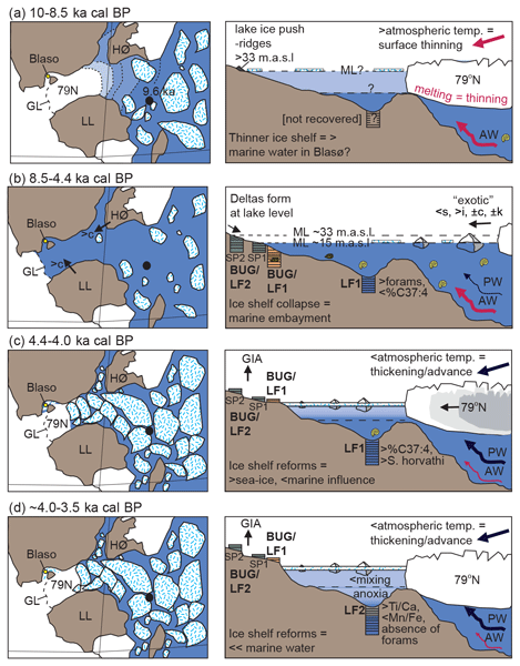
The Greenland Ice Sheet is melting at an accelerating rate. To understand the significance of these changes we reconstruct the history of one of its fringing ice shelves, known as 79° N ice shelf. We show that the ice shelf disappeared 8500 years ago, following a period of enhanced warming. An important implication of our study is that 79° N ice shelf is susceptible to collapse when atmospheric and ocean temperatures are ~2°C warmer than present, which could occur by the middle of this century.

Bertie W. J. Miles, Chris R. Stokes, Adrian Jenkins, Jim R. Jordan, Stewart S. R. Jamieson, and G. Hilmar Gudmundsson
The Cryosphere, 17, 445–456, https://doi.org/10.5194/tc-17-445-2023, https://doi.org/10.5194/tc-17-445-2023, 2023
Short summary
Short summary
Satellite observations have shown that the Shirase Glacier catchment in East Antarctica has been gaining mass over the past 2 decades, a trend largely attributed to increased snowfall. Our multi-decadal observations of Shirase Glacier show that ocean forcing has also contributed to some of this recent mass gain. This has been caused by strengthening easterly winds reducing the inflow of warm water underneath the Shirase ice tongue, causing the glacier to slow down and thicken.

Fiona J. Clubb, Eliot F. Weir, and Simon M. Mudd
Earth Surf. Dynam., 10, 437–456, https://doi.org/10.5194/esurf-10-437-2022, https://doi.org/10.5194/esurf-10-437-2022, 2022
Short summary
Short summary
River valleys are important components of mountain systems: they are the most fertile part of landscapes and store sediment which is transported from mountains to surrounding basins. Our knowledge of the location and shape of valleys is hindered by our ability to measure them over large areas. We present a new method for measuring the width of mountain valleys continuously along river channels from digital topography and show that our method can be used to test common models of river widening.

Erin L. McClymont, Michael J. Bentley, Dominic A. Hodgson, Charlotte L. Spencer-Jones, Thomas Wardley, Martin D. West, Ian W. Croudace, Sonja Berg, Darren R. Gröcke, Gerhard Kuhn, Stewart S. R. Jamieson, Louise Sime, and Richard A. Phillips
Clim. Past, 18, 381–403, https://doi.org/10.5194/cp-18-381-2022, https://doi.org/10.5194/cp-18-381-2022, 2022
Short summary
Short summary
Sea ice is important for our climate system and for the unique ecosystems it supports. We present a novel way to understand past Antarctic sea-ice ecosystems: using the regurgitated stomach contents of snow petrels, which nest above the ice sheet but feed in the sea ice. During a time when sea ice was more extensive than today (24 000–30 000 years ago), we show that snow petrel diet had varying contributions of fish and krill, which we interpret to show changing sea-ice distribution.
David G. Milledge, Dino G. Bellugi, Jack Watt, and Alexander L. Densmore
Nat. Hazards Earth Syst. Sci., 22, 481–508, https://doi.org/10.5194/nhess-22-481-2022, https://doi.org/10.5194/nhess-22-481-2022, 2022
Short summary
Short summary
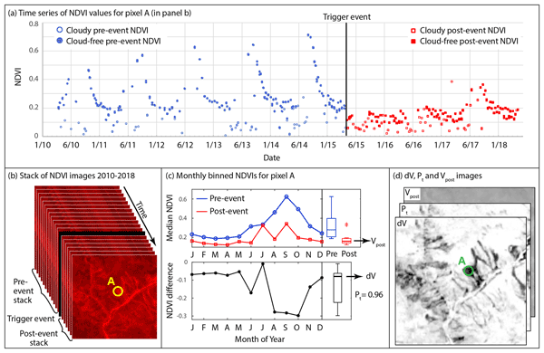
Earthquakes can trigger thousands of landslides, causing severe and widespread damage. Efforts to understand what controls these landslides rely heavily on costly and time-consuming manual mapping from satellite imagery. We developed a new method that automatically detects landslides triggered by earthquakes using thousands of free satellite images. We found that in the majority of cases, it was as skilful at identifying the locations of landslides as the manual maps that we tested it against.
Jamey Stutz, Andrew Mackintosh, Kevin Norton, Ross Whitmore, Carlo Baroni, Stewart S. R. Jamieson, Richard S. Jones, Greg Balco, Maria Cristina Salvatore, Stefano Casale, Jae Il Lee, Yeong Bae Seong, Robert McKay, Lauren J. Vargo, Daniel Lowry, Perry Spector, Marcus Christl, Susan Ivy Ochs, Luigia Di Nicola, Maria Iarossi, Finlay Stuart, and Tom Woodruff
The Cryosphere, 15, 5447–5471, https://doi.org/10.5194/tc-15-5447-2021, https://doi.org/10.5194/tc-15-5447-2021, 2021
Short summary
Short summary
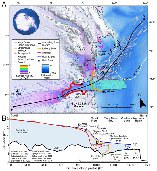
Understanding the long-term behaviour of ice sheets is essential to projecting future changes due to climate change. In this study, we use rocks deposited along the margin of the David Glacier, one of the largest glacier systems in the world, to reveal a rapid thinning event initiated over 7000 years ago and endured for ~ 2000 years. Using physical models, we show that subglacial topography and ocean heat are important drivers for change along this sector of the Antarctic Ice Sheet.
Cited articles
Aitken, A. R. A., Roberts, J. L., Ommen, T. D. V., Young, D. A., Golledge, N. R., Greenbaum, J. S., Blankenship, D. D., and Siegert, M. J.: Repeated large-scale retreat and advance of Totten Glacier indicated by inland bed erosion, Nature, 533, 385–389, https://doi.org/10.1038/nature17447, 2016.
An, M., Wiens, D. A., Zhao, Y., Feng, M., Nyblade, A. A., Kanao, M., Li, Y., Maggi, A., and Lévêque, J.: S-velocity model and inferred Moho topography beneath the Antarctic Plate from Rayleigh waves, J. Geophys. Res.-Sol. Ea., 120, 359–383, https://doi.org/10.1002/2014JB011332, 2015.
Anderson, R. S., Molnar, P., and Kessler, M. A.: Features of glacial valley profiles simply explained, J. Geophys. Res., 111, 2005JF000344, https://doi.org/10.1029/2005JF000344, 2006.
Bell, R. E., Ferraccioli, F., Creyts, T. T., Braaten, D., Corr, H., Das, I., Damaske, D., Frearson, N., Jordan, T., Rose, K., Studinger, M., and Wolovick, M.: Widespread Persistent Thickening of the East Antarctic Ice Sheet by Freezing from the Base, Science, 331, 1592–1595, https://doi.org/10.1126/science.1200109, 2011.
Bingham, R. G. and Siegert, M. J.: Quantifying subglacial bed roughness in Antarctica: implications for ice-sheet dynamics and history, Quaternary Sci. Rev., 28, 223–236, https://doi.org/10.1016/j.quascirev.2008.10.014, 2009.
Bo, S., Siegert, M. J., Mudd, S. M., Sugden, D., Fujita, S., Xiangbin, C., Yunyun, J., Xueyuan, T., and Yuansheng, L.: The Gamburtsev mountains and the origin and early evolution of the Antarctic Ice Sheet, Nature, 459, 690–693, https://doi.org/10.1038/nature08024, 2009.
Brocklehurst, S. H. and Whipple, K. X.: Assessing the relative efficiency of fluvial and glacial erosion through simulation of fluvial landscapes, Geomorphology, 75, 283–299, https://doi.org/10.1016/j.geomorph.2005.07.028, 2006.
Campforts, B. and Govers, G.: Keeping the edge: A numerical method that avoids knickpoint smearing when solving the stream power law, J. Geophys. Res.-Earth, 120, 1189–1205, https://doi.org/10.1002/2014JF003376, 2015.
Campforts, B., Schwanghart, W., and Govers, G.: Accurate simulation of transient landscape evolution by eliminating numerical diffusion: the TTLEM 1.0 model, Earth Surf. Dynam., 5, 47–66, https://doi.org/10.5194/esurf-5-47-2017, 2017.
Chang, M., Jamieson, S. S. R., Bentley, M. J., and Stokes, C. R.: The surficial and subglacial geomorphology of western Dronning Maud Land, Antarctica, J. Maps, 12, 892–903, https://doi.org/10.1080/17445647.2015.1097289, 2016.
Contreras-Reyes, E. and Osses, A.: Lithospheric flexure modelling seaward of the Chile trench: implications for oceanic plate weakening in the Trench Outer Rise region: Outer-rise flexure modelling off Chile, Geophys. J. Int., 182, 97–112, https://doi.org/10.1111/j.1365-246X.2010.04629.x, 2010.
Cook, S. J. and Swift, D. A.: Subglacial basins: Their origin and importance in glacial systems and landscapes, Earth-Sci. Rev., 115, 332–372, https://doi.org/10.1016/j.earscirev.2012.09.009, 2012.
Cox, S. C., Smith Lyttle, B., Elkind, S., Smith Siddoway, C., Morin, P., Capponi, G., Abu-Alam, T., Ballinger, M., Bamber, L., Kitchener, B., Lelli, L., Mawson, J., Millikin, A., Dal Seno, N., Whitburn, L., White, T., Burton-Johnson, A., Crispini, L., Elliot, D., Elvevold, S., Goodge, J., Halpin, J., Jacobs, J., Martin, A. P., Mikhalsky, E., Morgan, F., Scadden, P., Smellie, J., and Wilson, G.: A continent-wide detailed geological map dataset of Antarctica, Sci. Data, 10, 250, https://doi.org/10.1038/s41597-023-02152-9, 2023.
Cox, S. E., Thomson, S. N., Reiners, P. W., Hemming, S. R., and Van De Flierdt, T.: Extremely low long-term erosion rates around the Gamburtsev Mountains in interior East Antarctica, Geophys. Res. Lett., 37, 2010GL045106, https://doi.org/10.1029/2010GL045106, 2010.
Coxall, H. K., Wilson, P. A., Pälike, H., Lear, C. H., and Backman, J.: Rapid stepwise onset of Antarctic glaciation and deeper calcite compensation in the Pacific Ocean, Nature, 433, 53–57, https://doi.org/10.1038/nature03135, 2005.
Crameri, F., Shephard, G. E., and Heron, P. J.: The misuse of colour in science communication, Nat. Commun., 11, 5444, https://doi.org/10.1038/s41467-020-19160-7, 2020.
Creyts, T. T., Ferraccioli, F., Bell, R. E., Wolovick, M., Corr, H., Rose, K. C., Frearson, N., Damaske, D., Jordan, T., Braaten, D., and Finn, C.: Freezing of ridges and water networks preserves the Gamburtsev Subglacial Mountains for millions of years, Geophys. Res. Lett., 41, 8114–8122, https://doi.org/10.1002/2014GL061491, 2014.
Croissant, T. and Braun, J.: Constraining the stream power law: a novel approach combining a landscape evolution model and an inversion method, Earth Surf. Dynam., 2, 155–166, https://doi.org/10.5194/esurf-2-155-2014, 2014.
Daly, M. C., Green, P., Watts, A. B., Davies, O., Chibesakunda, F., and Walker, R.: Tectonics and Landscape of the Central African Plateau and their Implications for a Propagating Southwestern Rift in Africa, Geochem. Geophy. Geosy., 21, e2019GC008746, https://doi.org/10.1029/2019GC008746, 2020.
Deal, E. and Prasicek, G.: The Sliding Ice Incision Model: A New Approach to Understanding Glacial Landscape Evolution, Geophys. Res. Lett., 48, e2020GL089263, https://doi.org/10.1029/2020GL089263, 2021.
DeConto, R. M. and Pollard, D.: Rapid Cenozoic glaciation of Antarctica induced by declining atmospheric CO2, Nature, 421, 245–249, https://doi.org/10.1038/nature01290, 2003.
Demoulin, A., Beckers, A., and Hubert-Ferrari, A.: Patterns of Quaternary uplift of the Corinth rift southern border (N Peloponnese, Greece) revealed by fluvial landscape morphometry, Geomorphology, 246, 188–204, https://doi.org/10.1016/j.geomorph.2015.05.032, 2015.
Densmore, A. L., Dawers, N. H., Gupta, S., and Guidon, R.: What sets topographic relief in extensional footwalls?, Geology, 33, 453, https://doi.org/10.1130/G21440.1, 2005.
Densmore, A. L., Gupta, S., Allen, P. A., and Dawers, N. H.: Transient landscapes at fault tips, J. Geophys. Res., 112, 2006JF000560, https://doi.org/10.1029/2006JF000560, 2007.
Densmore, A. L., Hetzel, R., Ivy-Ochs, S., Krugh, W. C., Dawers, N., and Kubik, P.: Spatial variations in catchment-averaged denudation rates from normal fault footwalls, Geology, 37, 1139–1142, https://doi.org/10.1130/G30164A.1, 2009.
Duvall, A., Kirby, E., and Burbank, D.: Tectonic and lithologic controls on bedrock channel profiles and processes in coastal California, J. Geophys. Res., 109, 2003JF000086, https://doi.org/10.1029/2003JF000086, 2004.
Eagles, G., Golynsky, A. V., Kim, H. R., Paxman, G. J. G., and Ferraccioli, F.: ADMAP's Antarctic magnetic anomaly grids transformed for use with open source software, PANGAEA [data set], https://doi.org/10.1594/PANGAEA.965433, 2024.
Ebinger, C. J., Karner, G. D., and Weissel, J. K.: Mechanical strength of extended continental lithosphere: Constraints from the Western Rift System, East Africa, Tectonics, 10, 1239–1256, https://doi.org/10.1029/91TC00579, 1991.
Ferraccioli, F., Finn, C. A., Jordan, T. A., Bell, R. E., Anderson, L. M., and Damaske, D.: East Antarctic rifting triggers uplift of the Gamburtsev Mountains, Nature, 479, 388–392, https://doi.org/10.1038/nature10566, 2011.
Fitzgerald, P. G. and Goodge, J. W.: Exhumation and tectonic history of inaccessible subglacial interior East Antarctica from thermochronology on glacial erratics, Nat. Commun., 13, 6217, https://doi.org/10.1038/s41467-022-33791-y, 2022.
Flint, J. J.: Stream gradient as a function of order, magnitude, and discharge, Water Resour. Res., 10, 969–973, https://doi.org/10.1029/WR010i005p00969, 1974.
Francis, J. E., Marenssi, S., Levy, R., Hambrey, M., Thorn, V. C., Mohr, B., Brinkhuis, H., Warnaar, J., Zachos, J., Bohaty, S., and DeConto, R.: Chapter 8 From Greenhouse to Icehouse – The Eocene/Oligocene in Antarctica, in: Developments in Earth and Environmental Sciences, vol. 8, edited by: Florindo, F. and Siegert, M., Elsevier, 309–368, https://doi.org/10.1016/S1571-9197(08)00008-6, 2008.
Frémand, A. C., Bodart, J. A., Jordan, T. A., Ferraccioli, F., Robinson, C., Corr, H. F. J., Peat, H. J., Bingham, R. G., and Vaughan, D. G.: British Antarctic Survey's aerogeophysical data: releasing 25 years of airborne gravity, magnetic, and radar datasets over Antarctica, Earth Syst. Sci. Data, 14, 3379–3410, https://doi.org/10.5194/essd-14-3379-2022, 2022.
Gernon, T. M., Hincks, T. K., Goodwin, P., Paxman, G. J. G., Brune, S., Rohling, E. J., Keir, D., and Braun, J.: Continental breakup–driven uplift instigated East Antarctic Ice Sheet formation, Science, 393, eadz6758, https://doi.org/10.1126/science.adz6758, 2026.
Golynsky, A. V., Ferraccioli, F., Hong, J. K., Golynsky, D. A., Von Frese, R. R. B., Young, D. A., Blankenship, D. D., Holt, J. W., Ivanov, S. V., Kiselev, A. V., Masolov, V. N., Eagles, G., Gohl, K., Jokat, W., Damaske, D., Finn, C., Aitken, A., Bell, R. E., Armadillo, E., Jordan, T. A., Greenbaum, J. S., Bozzo, E., Caneva, G., Forsberg, R., Ghidella, M., Galindo-Zaldivar, J., Bohoyo, F., Martos, Y. M., Nogi, Y., Quartini, E., Kim, H. R., and Roberts, J. L.: New Magnetic Anomaly Map of the Antarctic, Geophys. Res. Lett., 45, 6437–6449, https://doi.org/10.1029/2018GL078153, 2018.
Goren, L., Fox, M., and Willett, S. D.: Tectonics from fluvial topography using formal linear inversion: Theory and applications to the Inyo Mountains, California, J. Geophys. Res.-Earth, 119, 1651–1681, https://doi.org/10.1002/2014JF003079, 2014.
Gulick, S. P. S., Shevenell, A. E., Montelli, A., Fernandez, R., Smith, C., Warny, S., Bohaty, S. M., Sjunneskog, C., Leventer, A., Frederick, B., and Blankenship, D. D.: Initiation and long-term instability of the East Antarctic Ice Sheet, Nature, 552, 225–229, https://doi.org/10.1038/nature25026, 2017.
Halberstadt, A. R. W., Gasson, E., Pollard, D., Marschalek, J., and DeConto, R. M.: Geologically constrained 2-million-year-long simulations of Antarctic Ice Sheet retreat and expansion through the Pliocene, Nat. Commun., 15, 7014, https://doi.org/10.1038/s41467-024-51205-z, 2024.
Hazzard, J. A. N., Richards, F. D., Goes, S. D. B., and Roberts, G. G.: Probabilistic Assessment of Antarctic Thermomechanical Structure: Impacts on Ice Sheet Stability, J. Geophys. Res.-Sol. Ea., 128, e2023JB026653, https://doi.org/10.1029/2023JB026653, 2023.
Hergarten, S., Robl, J., and Stüwe, K.: Tectonic geomorphology at small catchment sizes – extensions of the stream-power approach and the χ method, Earth Surf. Dynam., 4, 1–9, https://doi.org/10.5194/esurf-4-1-2016, 2016.
Howard, A. D.: A detachment-limited model of drainage basin evolution, Water Resour. Res., 30, 2261–2285, https://doi.org/10.1029/94WR00757, 1994.
Howard, A. D. and Kerby, G.: Channel changes in badlands, Geol. Soc. Am. Bull, 94, 739, https://doi.org/10.1130/0016-7606(1983)94<739:CCIB>2.0.CO;2, 1983.
Howat, I. M., Porter, C., Smith, B. E., Noh, M.-J., and Morin, P.: The Reference Elevation Model of Antarctica, The Cryosphere, 13, 665–674, https://doi.org/10.5194/tc-13-665-2019, 2019.
Jamieson, S. S. R., Hulton, N. R. J., Sugden, D. E., Payne, A. J., and Taylor, J.: Cenozoic landscape evolution of the Lambert basin, East Antarctica: the relative role of rivers and ice sheets, Global Planet. Change, 45, 35–49, https://doi.org/10.1016/j.gloplacha.2004.09.015, 2005.
Jamieson, S. S. R., Sugden, D. E., and Hulton, N. R. J.: The evolution of the subglacial landscape of Antarctica, Earth Planet. Sc. Lett., 293, 1–27, https://doi.org/10.1016/j.epsl.2010.02.012, 2010.
Jezek, K., Curlander, J., Carsey, F., Wales, C., and Barry, R.: RAMP AMM-1 SAR Image Mosaic of Antarctica, Version 2, NASA National Snow and Ice Data Center Distributed Active Archive Center [data set], Boulder, Colorado, USA, https://doi.org/10.5067/8AF4ZRPULS4H, 2013.
Kehew, A. E., Piotrowski, J. A., and Jørgensen, F.: Tunnel valleys: Concepts and controversies — A review, Earth-Sci. Rev., 113, 33–58, https://doi.org/10.1016/j.earscirev.2012.02.002, 2012.
Koppes, M. N. and Montgomery, D. R.: The relative efficacy of fluvial and glacial erosion over modern to orogenic timescales, Nat. Geosci., 2, 644–647, https://doi.org/10.1038/ngeo616, 2009.
Lague, D.: The stream power river incision model: evidence, theory and beyond, Earth Surf. Proc. Land., 39, 38–61, https://doi.org/10.1002/esp.3462, 2014.
Lavier, L. L. and Buck, W. R.: Half graben versus large-offset low-angle normal fault: Importance of keeping cool during normal faulting, J. Geophys. Res., 107, https://doi.org/10.1029/2001JB000513, 2002.
Licht, K. J. and Hemming, S. R.: Analysis of Antarctic glacigenic sediment provenance through geochemical and petrologic applications, Quaternary Sci. Rev., 164, 1–24, https://doi.org/10.1016/j.quascirev.2017.03.009, 2017.
Lloyd, C. T., Clark, C. D., and Swift, D. A.: The effect of valley confluence and bedrock geology upon the location and depth of glacial overdeepenings, Geografiska Annaler: Series A, Phy. Geogr., 105, 65–90, https://doi.org/10.1080/04353676.2023.2217047, 2023.
Lough, A. C., Wiens, D. A., and Nyblade, A.: Reactivation of ancient Antarctic rift zones by intraplate seismicity, Nat. Geosci., 11, 515–519, https://doi.org/10.1038/s41561-018-0140-6, 2018.
MacGregor, J. A., Boisvert, L. N., Medley, B., Petty, A. A., Harbeck, J. P., Bell, R. E., Blair, J. B., Blanchard-Wrigglesworth, E., Buckley, E. M., Christoffersen, M. S., Cochran, J. R., Csathó, B. M., De Marco, E. L., Dominguez, R. T., Fahnestock, M. A., Farrell, S. L., Gogineni, S. P., Greenbaum, J. S., Hansen, C. M., Hofton, M. A., Holt, J. W., Jezek, K. C., Koenig, L. S., Kurtz, N. T., Kwok, R., Larsen, C. F., Leuschen, C. J., Locke, C. D., Manizade, S. S., Martin, S., Neumann, T. A., Nowicki, S. M. J., Paden, J. D., Richter-Menge, J. A., Rignot, E. J., Rodríguez-Morales, F., Siegfried, M. R., Smith, B. E., Sonntag, J. G., Studinger, M., Tinto, K. J., Truffer, M., Wagner, T. P., Woods, J. E., Young, D. A., and Yungel, J. K.: The Scientific Legacy of NASA's Operation IceBridge, Rev. Geophys., 59, e2020RG000712, https://doi.org/10.1029/2020RG000712, 2021.
Miller, K. G., Schmelz, W. J., Browning, J. V., Rosenthal, Y., Hess, A. V., Kopp, R. E., and Wright, J. D.: Global Mean and Relative Sea-Level Changes Over the Past 66 Myr: Implications for Early Eocene Ice Sheets, Earth Sci. Syst. Soc., 3, 10091, https://doi.org/10.3389/esss.2023.10091, 2024.
Mouginot, J., Rignot, E., and Scheuchl, B.: Continent-Wide, Interferometric SAR Phase, Mapping of Antarctic Ice Velocity, Geophys. Res. Lett., 46, 9710–9718, https://doi.org/10.1029/2019GL083826, 2019.
Mudd, S. M., Attal, M., Milodowski, D. T., Grieve, S. W. D., and Valters, D. A.: A statistical framework to quantify spatial variation in channel gradients using the integral method of channel profile analysis, J. Geophys. Res.-Earth, 119, 138–152, https://doi.org/10.1002/2013JF002981, 2014.
Mudd, S. M., Clubb, F. J., Gailleton, B., and Hurst, M. D.: How concave are river channels?, Earth Surf. Dynam., 6, 505–523, https://doi.org/10.5194/esurf-6-505-2018, 2018.
Mudd, S. M., Roda-Boluda, D. C., Goren, L., and Clubb, F. J.: Beyond the Long Profile, in: Treatise on Geomorphology, edited by: Shroder, J. F., Elsevier, 22–52, https://doi.org/10.1016/B978-0-12-818234-5.00026-2, 2022.
Ockenden, H., Bingham, R. G., Goldberg, D., Curtis, A., and Morlighem, M.: Complex mesoscale landscapes beneath Antarctica mapped from space, Science, 391, 314–319, https://doi.org/10.1126/science.ady2532, 2026.
Paxman, G., Clubb, F., Jamieson, S., and Densmore, A.: Valley longitudinal profiles record the fluvial landscape evolution and geological structure of the Gamburtsev Subglacial Mountains, East Antarctica: Datasets (1.0), Zenodo [data set], https://doi.org/10.5281/ZENODO.18620874, 2026.
Paxman, G. J. G.: Antarctic palaeotopography, Memoirs, 56, 231–251, https://doi.org/10.1144/M56-2020-7, 2023.
Paxman, G. J. G., Watts, A. B., Ferraccioli, F., Jordan, T. A., Bell, R. E., Jamieson, S. S. R., and Finn, C. A.: Erosion-driven uplift in the Gamburtsev Subglacial Mountains of East Antarctica, Earth Planet. Sc. Lett., 452, 1–14, https://doi.org/10.1016/j.epsl.2016.07.040, 2016.
Paxman, G. J. G., Jamieson, S. S. R., Ferraccioli, F., Jordan, T. A., Bentley, M. J., Ross, N., Forsberg, R., Matsuoka, K., Steinhage, D., Eagles, G., and Casal, T. G.: Subglacial Geology and Geomorphology of the Pensacola-Pole Basin, East Antarctica, Geochem. Geophy. Geosy., 20, 2786–2807, https://doi.org/10.1029/2018GC008126, 2019.
Paxman, G. J. G., Austermann, J., and Hollyday, A.: Total isostatic response to the complete unloading of the Greenland and Antarctic Ice Sheets, Sci. Rep., 12, 11399, https://doi.org/10.1038/s41598-022-15440-y, 2022.
Perron, J. T. and Royden, L.: An integral approach to bedrock river profile analysis, Earth Surf. Proc. Land., 38, 570–576, https://doi.org/10.1002/esp.3302, 2013.
Phillips, G. and Läufer, A. L.: Brittle deformation relating to the Carboniferous–Cretaceous evolution of the Lambert Graben, East Antarctica: A precursor for Cenozoic relief development in an intraplate and glaciated region, Tectonophysics, 471, 216–224, https://doi.org/10.1016/j.tecto.2009.02.012, 2009.
Portenga, E. W. and Bierman, P. R.: Understanding Earth's eroding surface with 10Be, GSA Today, 21, 4–10, https://doi.org/10.1130/G111A.1, 2011.
Pritchard, H. D., Fretwell, P. T., Fremand, A. C., Bodart, J. A., Kirkham, J. D., Aitken, A., Bamber, J., Bell, R., Bianchi, C., Bingham, R. G., Blankenship, D. D., Casassa, G., Christianson, K., Conway, H., Corr, H. F. J., Cui, X., Damaske, D., Damm, V., Dorschel, B., Drews, R., Eagles, G., Eisen, O., Eisermann, H., Ferraccioli, F., Field, E., Forsberg, R., Franke, S., Goel, V., Gogineni, S. P., Greenbaum, J., Hills, B., Hindmarsh, R. C. A., Hoffman, A. O., Holschuh, N., Holt, J. W., Humbert, A., Jacobel, R. W., Jansen, D., Jenkins, A., Jokat, W., Jong, L., Jordan, T. A., King, E. C., Kohler, J., Krabill, W., Maton, J., Gillespie, M. K., Langley, K., Lee, J., Leitchenkov, G., Leuschen, C., Luyendyk, B., MacGregor, J. A., MacKie, E., Moholdt, G., Matsuoka, K., Morlighem, M., Mouginot, J., Nitsche, F. O., Nost, O. A., Paden, J., Pattyn, F., Popov, S., Rignot, E., Rippin, D. M., Rivera, A., Roberts, J. L., Ross, N., Ruppel, A., Schroeder, D. M., Siegert, M. J., Smith, A. M., Steinhage, D., Studinger, M., Sun, B., Tabacco, I., Tinto, K. J., Urbini, S., Vaughan, D. G., Wilson, D. S., Young, D. A., and Zirizzotti, A.: Bedmap3 updated ice bed, surface and thickness gridded datasets for Antarctica, Sci. Data, 12, 414, https://doi.org/10.1038/s41597-025-04672-y, 2025.
Rohling, E. J., Foster, G. L., Gernon, T. M., Grant, K. M., Heslop, D., Hibbert, F. D., Roberts, A. P., and Yu, J.: Comparison and Synthesis of Sea-Level and Deep-Sea Temperature Variations Over the Past 40 Million Years, Rev. Geophys., 60, e2022RG000775, https://doi.org/10.1029/2022RG000775, 2022.
Rose, K. C., Ferraccioli, F., Jamieson, S. S. R., Bell, R. E., Corr, H., Creyts, T. T., Braaten, D., Jordan, T. A., Fretwell, P. T., and Damaske, D.: Early East Antarctic Ice Sheet growth recorded in the landscape of the Gamburtsev Subglacial Mountains, Earth Planet. Sc. Lett., 375, 1–12, https://doi.org/10.1016/j.epsl.2013.03.053, 2013.
Sangiorgi, F., Bijl, P. K., Passchier, S., Salzmann, U., Schouten, S., McKay, R., Cody, R. D., Pross, J., Van De Flierdt, T., Bohaty, S. M., Levy, R., Williams, T., Escutia, C., and Brinkhuis, H.: Southern Ocean warming and Wilkes Land ice sheet retreat during the mid-Miocene, Nat. Commun., 9, 317, https://doi.org/10.1038/s41467-017-02609-7, 2018.
Schroeder, D. M., Blankenship, D. D., Raney, R. K., and Grima, C.: Estimating Subglacial Water Geometry Using Radar Bed Echo Specularity: Application to Thwaites Glacier, West Antarctica, IEEE Geosci. Remote S., 12, 443–447, https://doi.org/10.1109/LGRS.2014.2337878, 2015.
Schwanghart, W. and Scherler, D.: Short Communication: TopoToolbox 2 – MATLAB-based software for topographic analysis and modeling in Earth surface sciences, Earth Surf. Dynam., 2, 1–7, https://doi.org/10.5194/esurf-2-1-2014, 2014.
Seiner, O., Hugney, A., Seroussi, H., and MacGregor, J. A.: A synthesis of the basal thermal state of the Antarctic ice sheet, J. Glaciol., 71, e127, https://doi.org/10.1017/jog.2025.10102, 2025.
Sleep, N. H.: Mantle plumes from top to bottom, Earth-Sci. Rev., 77, 231–271, https://doi.org/10.1016/j.earscirev.2006.03.007, 2006.
Smith, A. G. G., Fox, M., Schwanghart, W., and Carter, A.: Comparing methods for calculating channel steepness index, Earth-Sci. Rev., 227, 103970, https://doi.org/10.1016/j.earscirev.2022.103970, 2022.
Stock, J. D. and Montgomery, D. R.: Geologic constraints on bedrock river incision using the stream power law, J. Geophys. Res., 104, 4983–4993, https://doi.org/10.1029/98JB02139, 1999.
Summerfield, M. A. and Hulton, N. J.: Natural controls of fluvial denudation rates in major world drainage basins, J. Geophys. Res., 99, 13871–13883, https://doi.org/10.1029/94JB00715, 1994.
Taylor, J., Siegert, M. J., Payne, A. J., Hambrey, M. J., O'Brien, P. E., Cooper, A. K., and Leitchenkov, G.: Topographic controls on post-Oligocene changes in ice-sheet dynamics, Prydz Bay region, East Antarctica, Geology, 32, 197, https://doi.org/10.1130/G20275.1, 2004.
Thomson, S. N., Reiners, P. W., Hemming, S. R., and Gehrels, G. E.: The contribution of glacial erosion to shaping the hidden landscape of East Antarctica, Nat. Geosci., 6, 203–207, https://doi.org/10.1038/ngeo1722, 2013.
Van Breedam, J., Huybrechts, P., and Crucifix, M.: Modelling evidence for late Eocene Antarctic glaciations, Earth Planet. Sc. Lett., 586, 117532, https://doi.org/10.1016/j.epsl.2022.117532, 2022.
Van De Flierdt, T., Hemming, S. R., Goldstein, S. L., Gehrels, G. E., and Cox, S. E.: Evidence against a young volcanic origin of the Gamburtsev Subglacial Mountains, Antarctica, Geophys. Res. Lett., 35, 2008GL035564, https://doi.org/10.1029/2008GL035564, 2008.
van der Vegt, P., Janszen, A., and Moscariello, A.: Tunnel valleys: current knowledge and future perspectives, Geol. Soc. Spec. Publ., 368, 75–97, https://doi.org/10.1144/SP368.13, 2012.
Veevers, J. J., Saeed, A., Pearson, N., Belousova, E., and Kinny, P. D.: Zircons and clay from morainal Permian siltstone at Mt Rymill (73° S, 66° E), Prince Charles Mountains, Antarctica, reflect the ancestral Gamburtsev Subglacial Mountains–Vostok Subglacial Highlands complex, Gondwana Res., 14, 343–354, https://doi.org/10.1016/j.gr.2007.12.006, 2008.
Watts, A. B.: Isostasy and Flexure of the Lithosphere, 2nd ed., Cambridge University Press, https://doi.org/10.1017/9781139027748, 2023.
Weissel, J. K. and Karner, G. D.: Flexural uplift of rift flanks due to mechanical unloading of the lithosphere during extension, J. Geophys. Res., 94, 13919–13950, https://doi.org/10.1029/JB094iB10p13919, 1989.
Wessel, P., Luis, J. F., Uieda, L., Scharroo, R., Wobbe, F., Smith, W. H. F., and Tian, D.: The Generic Mapping Tools Version 6, Geochem. Geophy. Geosy., 20, 5556–5564, https://doi.org/10.1029/2019GC008515, 2019.
Westerhold, T., Marwan, N., Drury, A. J., Liebrand, D., Agnini, C., Anagnostou, E., Barnet, J. S. K., Bohaty, S. M., De Vleeschouwer, D., Florindo, F., Frederichs, T., Hodell, D. A., Holbourn, A. E., Kroon, D., Lauretano, V., Littler, K., Lourens, L. J., Lyle, M., Pälike, H., Röhl, U., Tian, J., Wilkens, R. H., Wilson, P. A., and Zachos, J. C.: An astronomically dated record of Earth's climate and its predictability over the last 66 million years, Science, 369, 1383–1387, https://doi.org/10.1126/science.aba6853, 2020.
Whipple, K. X. and Tucker, G. E.: Dynamics of the stream-power river incision model: Implications for height limits of mountain ranges, landscape response timescales, and research needs, J. Geophys. Res., 104, 17661–17674, https://doi.org/10.1029/1999JB900120, 1999.
Winter, K., Ross, N., Ferraccioli, F., Jordan, T. A., Corr, H. F. J., Forsberg, R., Matsuoka, K., Olesen, A. V., and Casal, T. G.: Topographic Steering of Enhanced Ice Flow at the Bottleneck Between East and West Antarctica, Geophys. Res. Lett., 45, 4899–4907, https://doi.org/10.1029/2018GL077504, 2018.
Wobus, C., Whipple, K. X., Kirby, E., Snyder, N., Johnson, J., Spyropolou, K., Crosby, B., and Sheehan, D.: Tectonics from topography: Procedures, promise, and pitfalls, in: Tectonics, Climate, and Landscape Evolution, editd by: Willett, S. D., Hovius, N., Brandon, M. T., and Fisher, D. M., Geological Society of America, https://doi.org/10.1130/2006.2398(04), 2006.
Wu, G., Ferraccioli, F., Zhou, W., Yuan, Y., Gao, J., and Tian, G.: Tectonic Implications for the Gamburtsev Subglacial Mountains, East Antarctica, from Airborne Gravity and Magnetic Data, Remote Sens., 15, 306, https://doi.org/10.3390/rs15020306, 2023.
Young, D. A., Paden, J. D., Yan, S., Kerr, M. E., Singh, S., Vega González, A., Kaundinya, S. R., Greenbaum, J. S., Chan, K., Ng, G., Buhl, D. P., Kempf, S. D., and Blankenship, D. D.: Coupled Ice Sheet Structure and Bedrock Geology in the Deep Interior of East Antarctica: Results From Dome A and the South Pole Basin, Geophys. Res. Lett., 52, e2025GL115729, https://doi.org/10.1029/2025GL115729, 2025.
Zondervan, J. R., Hilton, R. G., Dellinger, M., Clubb, F. J., Roylands, T., and Ogrič, M.: Rock organic carbon oxidation CO2 release offsets silicate weathering sink, Nature, 623, 329–333, https://doi.org/10.1038/s41586-023-06581-9, 2023.
Editorial statement
The paper by Paxman et al. presents a topographic analysis of the Gamburtsev Subglacial Mountains underneath the East Antarctic Ice Sheet. The authors analyse longitudinal valley profiles and apply concepts of fluvial landscape evolution to show that the subglacial landscape has a fluvial origin with a local glacial overprint. Based on channel steepness patterns, they determine the position of geological boundaries and assess the likely timing of tectonic uplift. Their analysis reveals that the South Pole Basin may contain sediment that could contain an archive of the formation and glaciation of the Gamburtsev Mountains.
The paper by Paxman et al. presents a topographic analysis of the Gamburtsev Subglacial...
Short summary
This study focusses on the Gamburtsev Subglacial Mountains, a 600 km-long mountain range that is completely hidden beneath the Antarctic Ice Sheet. We look at the valley networks within the Gamburtsevs and use these to understand how the mountains formed. Our main findings are that the valleys were first cut by rivers that existed before Antarctica was glaciated, the shape of the valleys is affected by the bedrock geology, and the mountains are probably younger than previously thought.
This study focusses on the Gamburtsev Subglacial Mountains, a 600 km-long mountain range that is...


